The Event: Pre-Run
And now for the main event!
The Morning Prep
We chose to stay at the Maswik Lodge in the Grand Canyon village so that we could simply roll out of bed and walk straight to the trailhead. This meant that our route was an out and back from the Bright Angel Trailhead. We didn’t get to experience the South Kaibab trail, but for first timers, I think keeping it this simple was a good choice. While it is a longer route to get to Phantom Ranch, there was water along the way, which the South Kaibab trail doesn’t have and that had us feeling a little more comfortable, just in case.
The morning of, we woke up at 2:30am and started the prep routine we had laid out the day before. This included hotel coffee (2x for me), making two cups of oatmeal with the hot water from the one-cup coffee machines in the room, eating a banana and getting an electrolyte drink down. This felt like enough food for me as the oatmeal was pretty filling and had a good amount of carbs. Pro tip: if you aren’t sure what kind of amenities you’ll have in your room, as long as you have a coffee maker, the little individual cups of oatmeal (Quaker, Bob’s Red Mill, etc.) all work really well by just heating water in the coffee maker directly into the cup of oatmeal and letting it sit for a couple minutes.
We were all ready to go a bit early, feeling excited and nervous to get started. We doubled checked our gear, took a quick picture and rolled out of there at 3:10am and walked the 5 minutes to the trailhead.
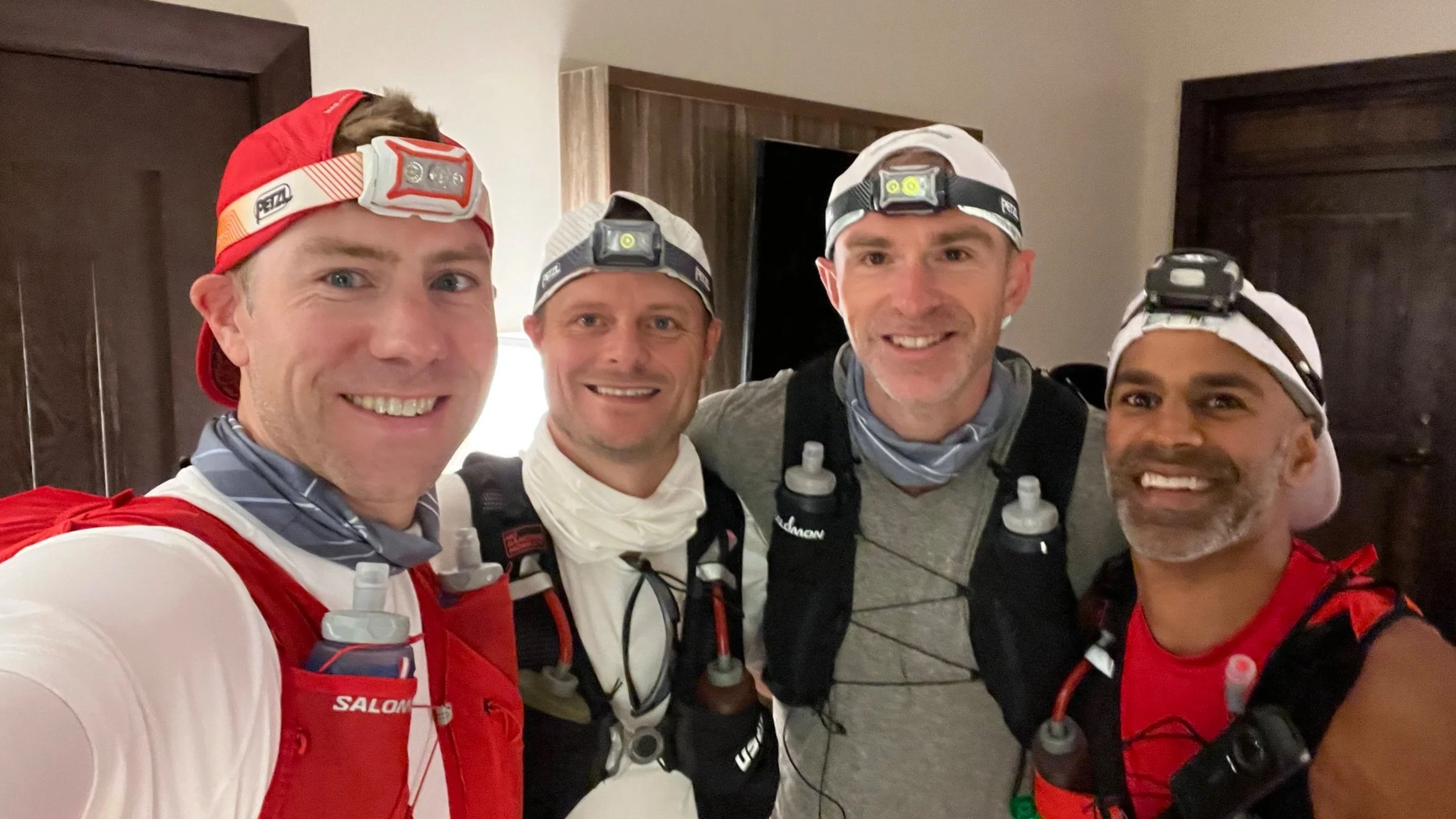
Everyone’s looking a bit tired, but ready to roll!
The Route:
With that background in place, let’s walk through the route. Evan, took the table of trail stops that you can find on the Grand Canyon website here, and turned it into a simple hand drawn route map for us (my notes at the top added). This map was printed and attached to everyone’s fridge so we could all visualize as we trained. Legendary.

Pseudo Topo map from our architect
This map was printed and posted on each of our refrigerators. Something to remind each of us what we had ahead to keep us motivated day after day in training.
This map helped us visually break down the run into sections based on where the water stops were, which helped us plan for when/how we would actually consume our nutrition and hydration. The reality was that it was so hot out there (105° in the bottom of the canyon by midday) that we ended up stopping at every water station we could to refill and reload. The key, however, was being mentally prepared for the two longer stretches between Phantom Ranch and Cottonwood, and between Manzanita and the North Rim trailhead.
Now this map is not even close to what the actual route looks like from an elevation perspective, and in fact, it kind of messed with me mentally because that section between Phantom Ranch and Manzanita is far from a nice gradual 8 mile uphill. The elevation map really looks like this (there and back):
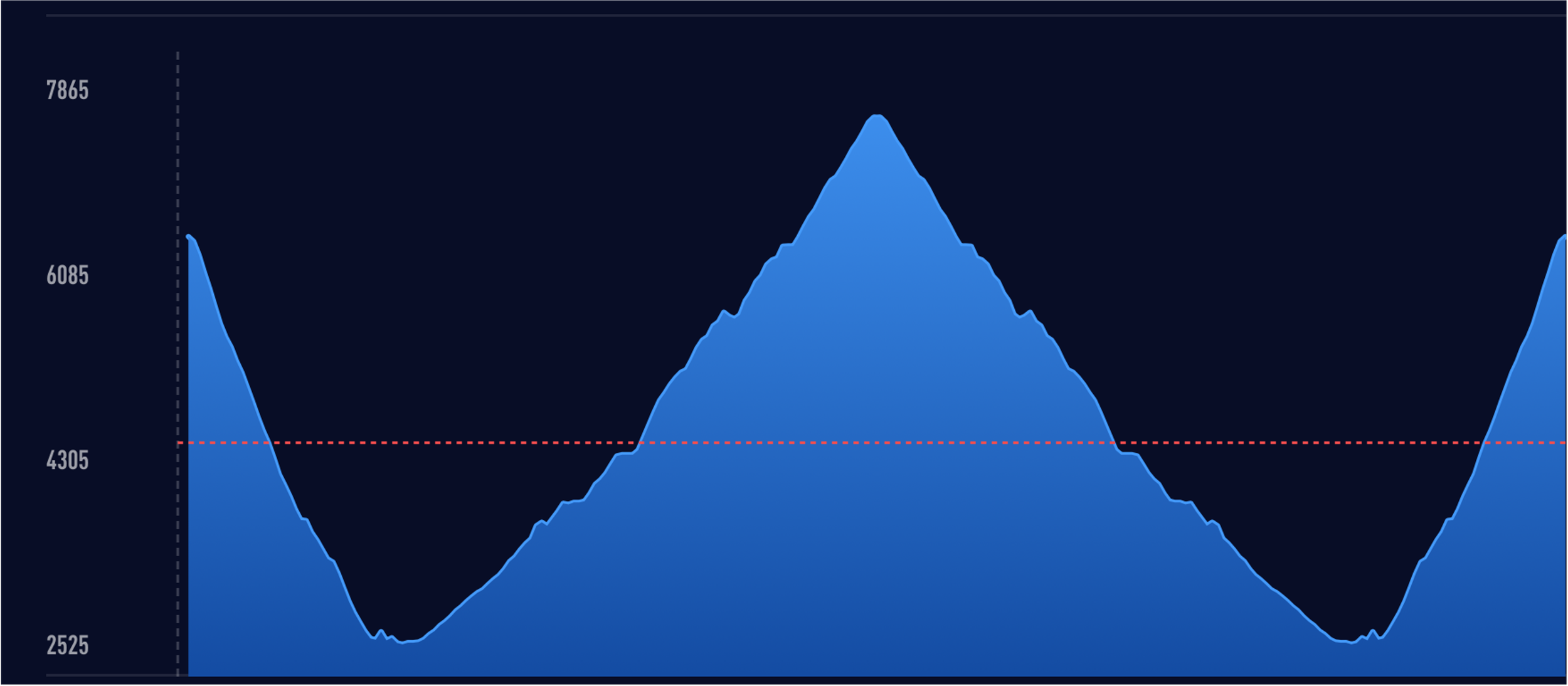
Elevation map per my Coros Pace watch
As you can see, there is actually a lot of climbing over that 8 mile stretch from Phantom to Manzanita, and Evan’s map didn’t really give us that sense, but I’ll get to that. Suffice it to say, we boarded the struggle bus a number of times…
Six Legs to Finish
We ultimately broke the run down into six legs, as my annotations show on Evan’s route map above. First was from the Bright Angel Trailhead to Phantom Ranch (10 miles), next was Phantom Ranch to Manzanita (8.2 miles), and finally Manzanita to the North Kaibab trailhead (5.1 miles). And then we turn around and do it in reverse.
The next six posts will walk through our experience by section. Enjoy our journey!