Section 2: Phantom Ranch to Manzanita
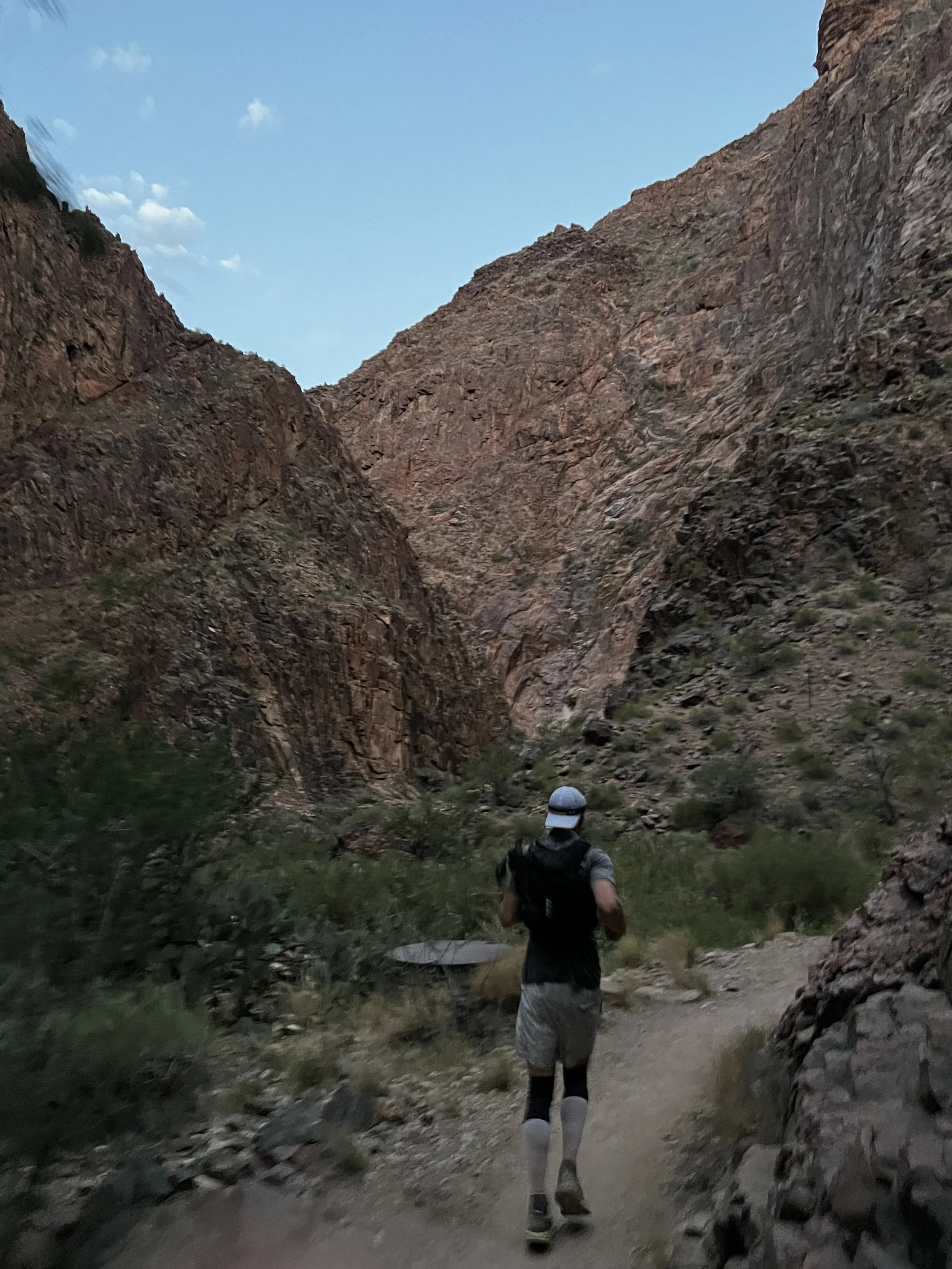
When we left Phantom Ranch, we were about 2:45 into the journey and it was still pitch black. We were now heading out of the campground into “the box,” which is a long stretch of canyon just North of the campground following Bright Angel Creek, which flows from the north rim down into the Colorado river. The majority of the trail North of Phantom Ranch follows the Bright Angel Creek, which is a great water source you can utilize if needed along the way.
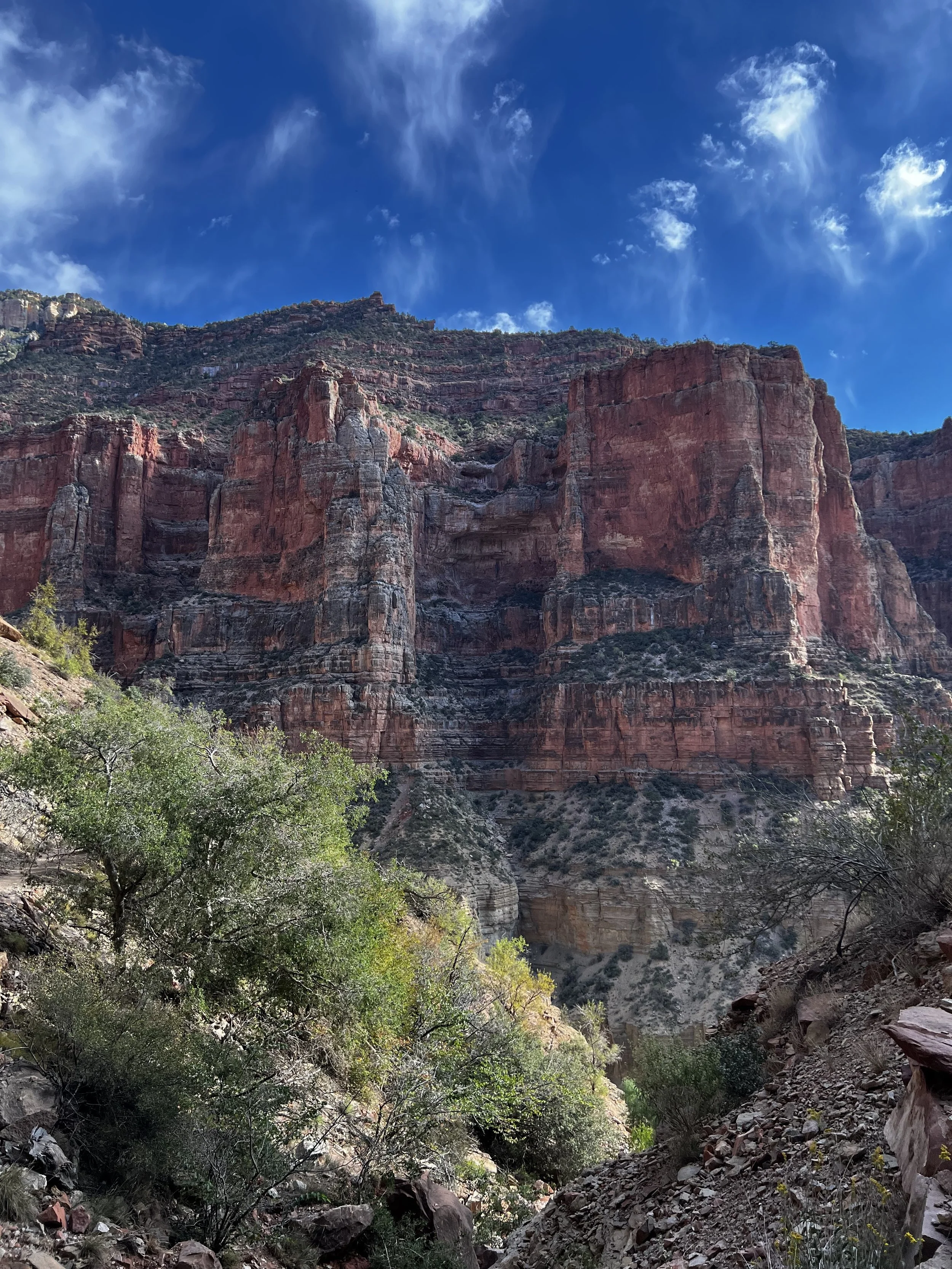
This is really a stunning section of the trail. In all my research I heard people talk about it as a slog and that it was super hot or challenging, but in both directions, I thought it was some of the most enjoyable trail. For one, in the early morning hours, the walls of this section are so high and tight around you that it feels like the canyon is a giant hand that’s closing in all around you. It’s a really cool feeling. You look high up and can see the light of the day starting to emerge, which was just a spectacular experience. Seeing the sun come up while we were in this section of the canyon was very cool. I wish I had a professional camera to capture it, but all I had was my iPhone and unfortunately I wasn’t really in “take pictures of everything” mode at that point so I don’t have a good shot to share.
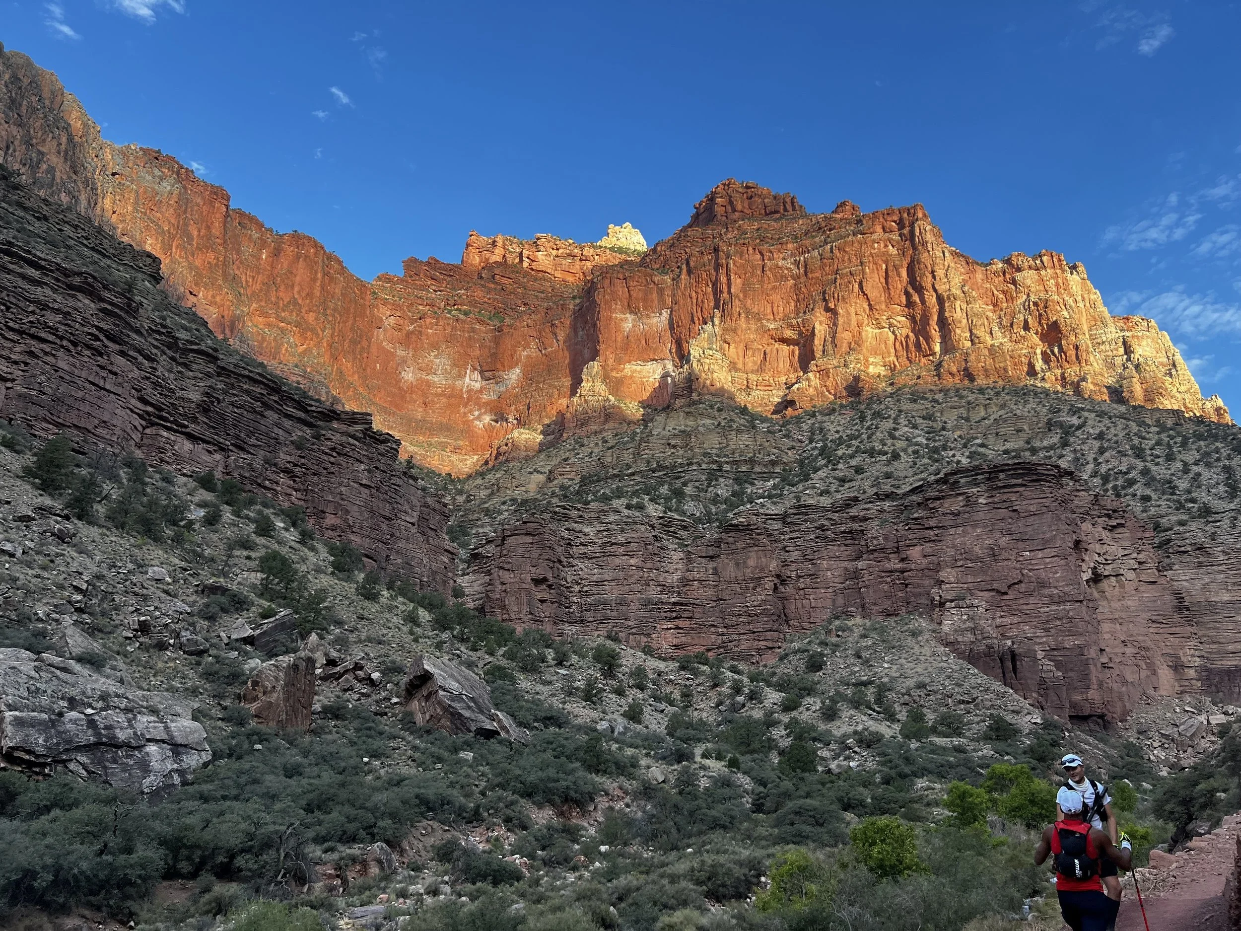
As you emerge from the box, you move into a long exposed section of the trail. In the morning this was great. The sun was barely coming out and it was still cool. Later in the day, that story changed, but for now, this was another very unique section that didn’t look like anything we had covered before. The trail was rolling, with some decent, but relatively short, climbs mixed with periodic flats. It was a far more varied terrain and elevation profile than I was expecting (silly me looking at Evan’s hand drawn map…).
At this point, we started seeing a lot of other people heading south. This was the crew of people that were getting an early start on a North to South rim to rim crossing and so there were a lot of cheery “good mornings” said, which was great for motivation. The other wonderful thing about seeing other people on the trail is that everyone who’s not totally beat, is super positive and encouraging. When you pass other people who are out there attempting something really challenging and they know you are too, there is a mutual respect that just makes everyone celebrate each other and it’s electric. I don’t know how many times we heard people say “you guys are awesome!” Or “Go get it!” Not to mention all the times we handed out similar encouragement.
This is part of the magic of the trail.
During this section, I started having some pain in my right hip, which was not a good sign that we were only about 18 miles in. It wasn’t completely debilitating, but it did start nagging and slowed me down a bit. I had to take a couple quick stops to stretch. This is the first spot where the negative thoughts started creeping in. More on that later…
Overall, this section was pretty tame and thoroughly enjoyable in the early morning. The sun hadn’t really come out in full and the energy on the trail was amazing. We were largely still on track with our nutrition and hydration and fitness felt good, other than the hip. The only thing that did become a bit worrisome was that this stretch was 7.2 miles (from Bright Angel Campground to Cottonwood Campground) without any water fill ups. Normally 7.2 miles is no issue with 1L of water, but there was a real elevation gain and the terrain made it so that our pace was around 11:00 miles so we were all consuming water a bit faster than we would have liked. We showed up to Cottonwood on empty and ready to get a full refill.
From there on, we knew the heat would set it and I pulled out my third half liter flask to have as a backup from there on out. And it’s a good thing too, because I used it on every subsequent section. Also, I mentioned this in the gear section, but the pole quiver came in especially handy here as a spot to hold the third flask. Since I was using my poles all the time now, I could slip the Salomon XA filter flask into the quiver and have it accessible to swap with one of the two front flasks whenever I ran dry. What a great little hack.
We made it to Cottonwood just in time to refill and then keep moving another 1.5 miles to Manzanita. Not a lot to say about Cottonwood campground other than we’re glad it was there. We got to Manzanita and reset, ready to hit the final climb to the North Kaibab trailhead.
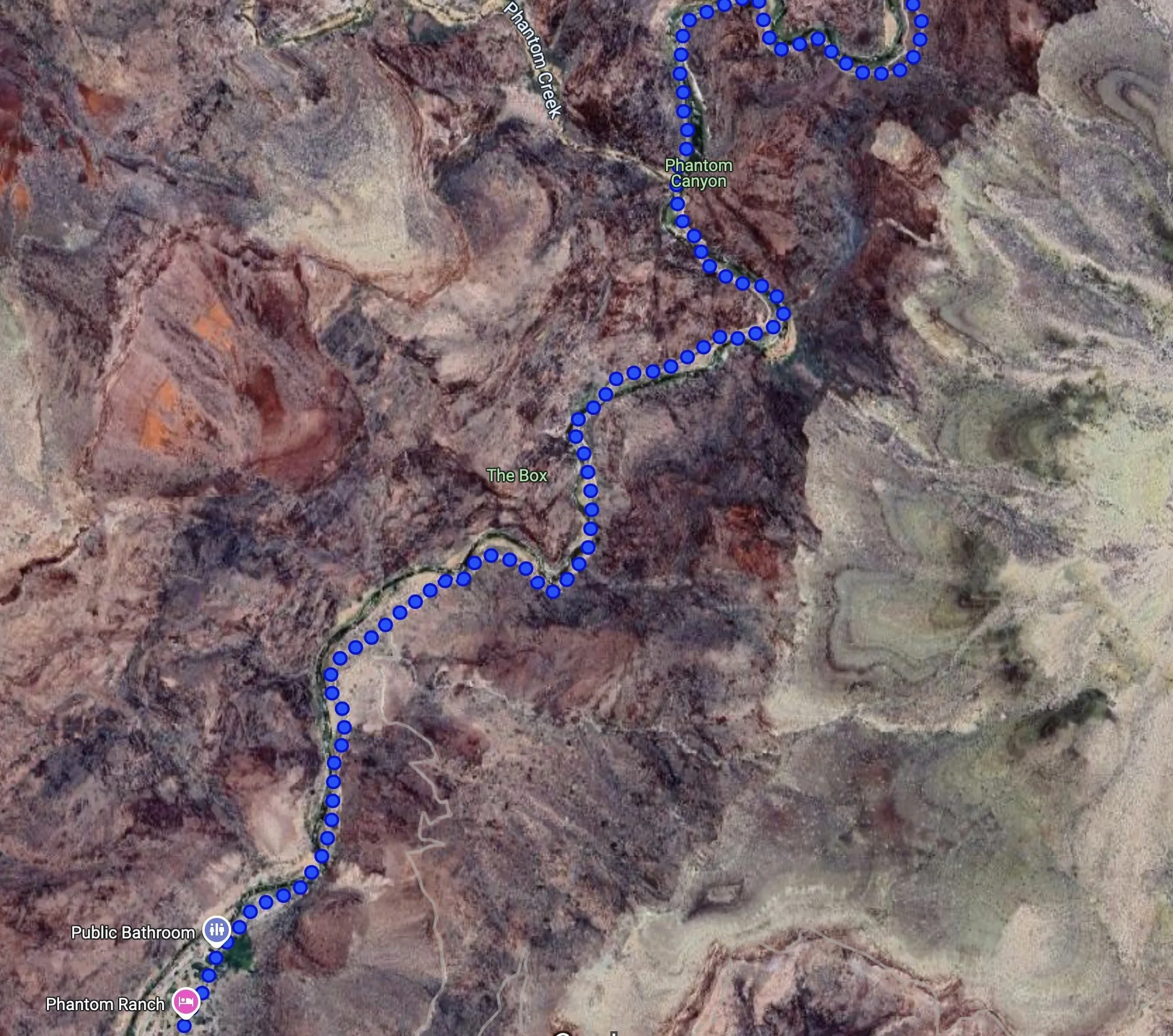
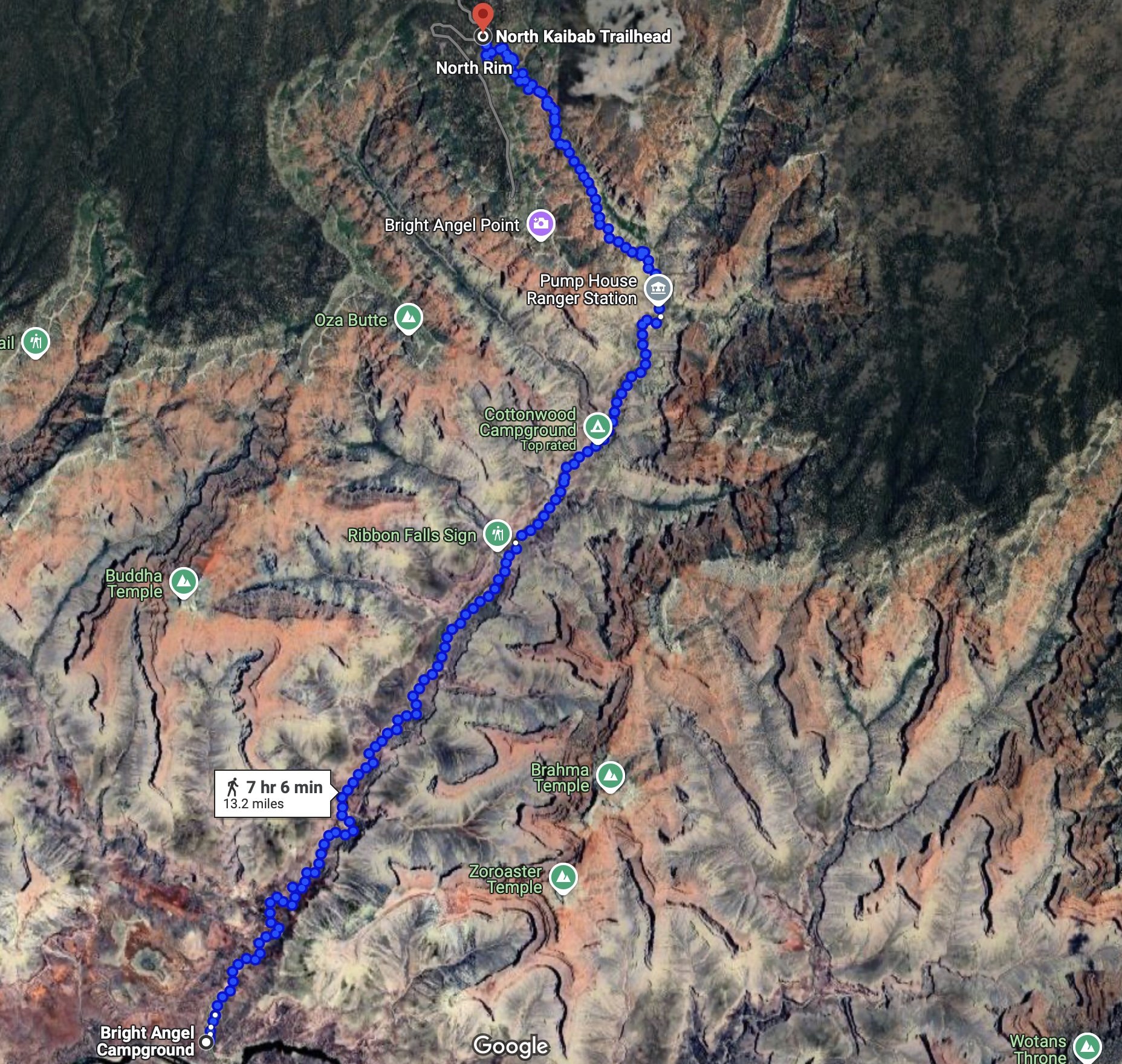
To get a feel for how the trail rolls, here is the route on google maps for reference. I suggest getting directions on the map and zooming around to see what it really looks like.
North of the river
Now up to the North Rim…